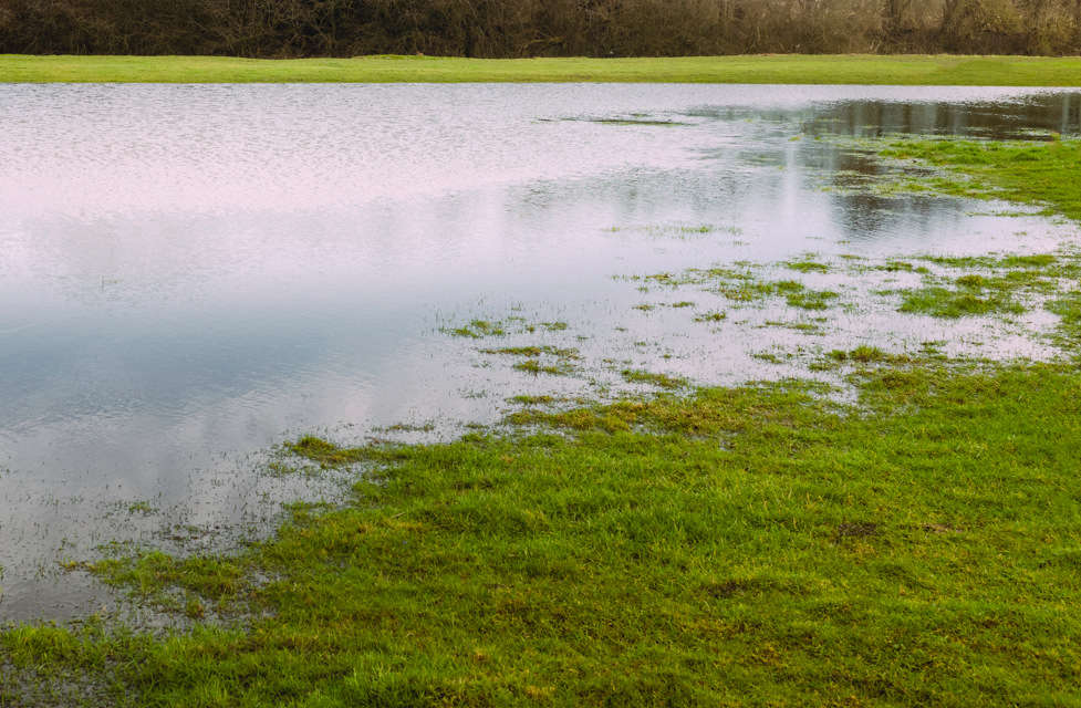
Days of heavy rain has led to flood warnings being issued on the Isle of Wight - with more than a month's rain falling in just 48 hours in some parts of the Island.
The Environment Agency said that flooding is expected for Sandown, Yaverland, Yarbridge, Brading and Bembridge on the Eastern Yar.
Meanwhile, a second warning is in place for Whitwell, Wroxall, Horringford, Langbridge and Alverstone.
Flooding is also likley at Lukely Brook, from Carisbrooke to Newport.
The Environment Agency said:
"Currently, there is extensive out of bank flooding throughout the Yar Valley. Moreton Common Road and Golf Links Road are flooded.
"Today (Thursday), Fort Holiday Park and Sandown sewage works could flood as ditches struggle to drain to the main river.
"Property flooding is possible at Nicholas Close, Brading.
"At Sandown, the river is expected to continue rising until Thursday night. We are operating the sluice at Bembridge to manage water levels across Brading marshes. However, the neap tide cycle will restrict the amount of water which can drain from the river for the next four days."
It went onto say:
"The water level in the Eastern Yar at Alverstone is high and rising. Over half a month’s rain (70mm) has been recorded in Wroxall since Tuesday morning (15/11/2022).
"Currently, the access track to Horringford will be flooded, restricting access. Golf Links Road, cycle tracks and footpaths across the Upper Yar Valley will be impassable.
"From midday today (Thursday) in Alverstone, the main road will flood near the main road bridge. Water will begin to surround property in Alverstone and Langbridge, where property flooding is possible.
"At Alverstone, the river will rise until 4pm. It will remain at its peak for several hours before the level begins to fall."


 Call For Islanders To Support Their Local Hospital And Get Vaccinated
 Isle Of Wight Council Unveils Plans For Public Transport Improvements
 Apply Now For Grant Funding To Help Strengthen Family Support On The Isle Of Wight
 More Charities Receive Major Island Roads Funding Boost
 From False Teeth To Cuddly Toys: What Do Forgetful Passengers Leave Behind On Wightlink’s Ferries?
 Pensioner Arrested Following Serious Collision In Sandown
 Flood Alert Issued For Isle of Wight Coast As Stormy Weather Arrives
 Here's Where You Can Dispose Of Your Real Christmas Tree
 Casualty Recovered After St Boniface Down Incident
 Green Homes Events: Could Your Home Benefit From Energy Improvements?
 Four Community Projects To Receive Major Grants To Continue Their Work
 Emergency Services Called To Three-Vehicle Arreton Crash
 Man Arrested Following Drug-Driving Collision Between Nettlestone And Ryde
 Inspirational Jack Takes On New Year Endurance Challenge For CALM
 Full Council To Debate Devolution And Potential Election Delay Amid Tight Government Deadlines
 Newport's Isorropia Foundation To Complete Purchase Of Medina Valley Centre Following £1m Award
 Memorial Held Following Death Of Kezi's Kindness Founder Nikki Flux-Edmonds
 Call To Return NHS And Social Care Equipment That Is No Longer Needed
 Severe Gales And Heavy Rain Forecast For New Year's Day On Isle Of Wight
 Another Blow For Newport Nightlife As Wyld Closure Announced


